Natick Center Environs Map, 1889 (No. 19)
Natick Center Environs Map, 1889 (No. 19)
$40.00
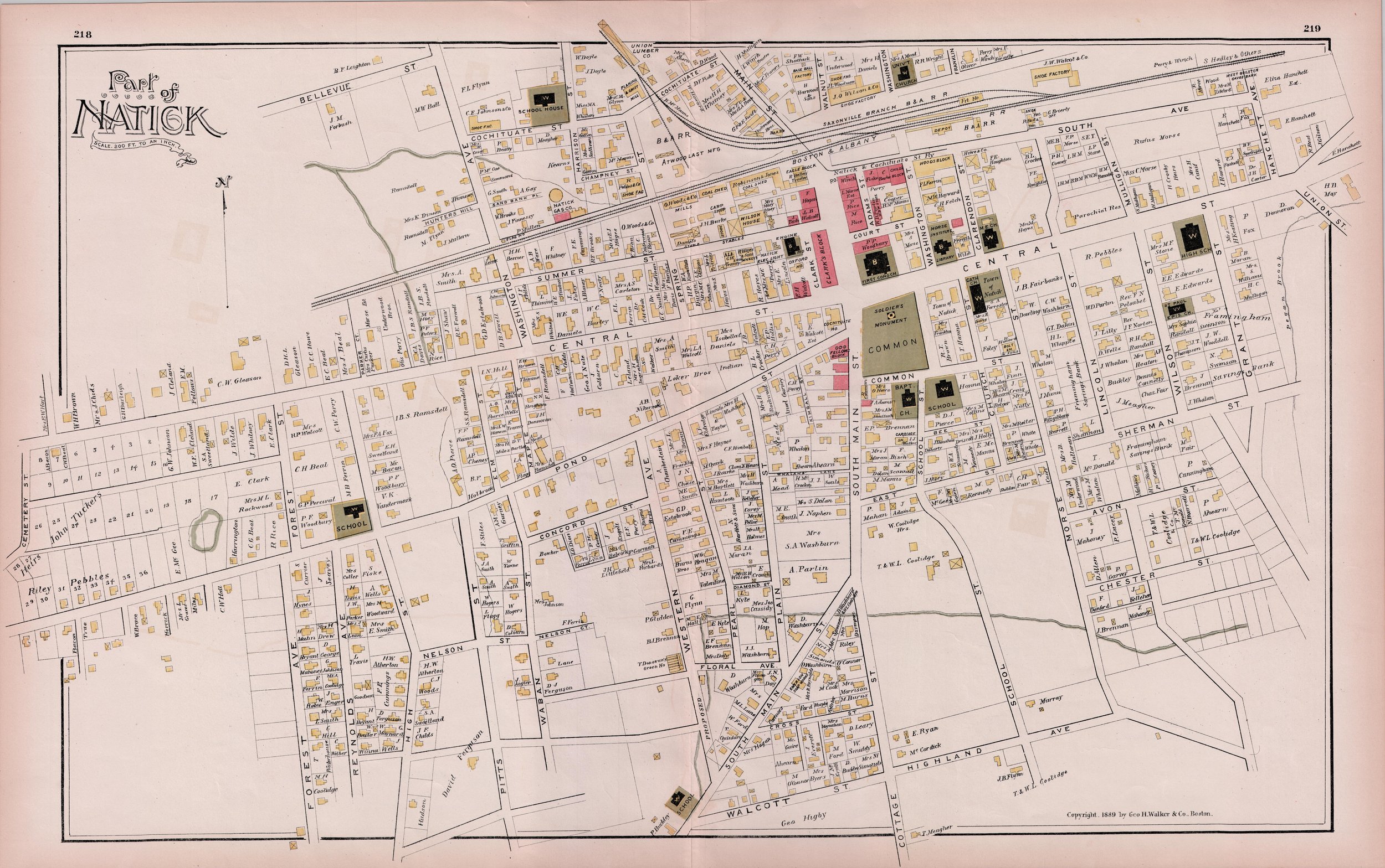
This map features Natick Center and environs, from Cochituate St (N) to Walcott St (S); Cemetery St (W) to Hanchett (now Dewey) St (E). It was first printed in 1889 by George Walker & Co. of Boston.
*If you want to ship this map to your address, please select the “map shipping” option ($8.00).
**Local residents can select “local delivery” from an NHS volunteer/staff member for a $5.00 fee or arrange to pick up merchandise at the Natick History Museum (free).
Quantity: